Holiday Letter 2021

Last Couple of Years

It’s been a few years since I last sent out a Christmas letter. Let me see if I can summarize the last three years. When we retired in March of 2018, we fully expected to spend 3-5 years traveling (with occasional breaks.)

In the first two years we did manage to put a dent in our travel plans. We made it to Spain, Mallorca, Germany, Hungary, Austria, Czech Republic, and Netherlands that first spring. After summer in New York, we rounded out the first year with Australia, Fiji and New Zealand.

2019 started off great with a winter swing from Florida through New Orleans and west to Arizona. As we left Utah in early March, an unexpected winter storm pushed us south, but we made our way back east to South Carolina.

Later in that second year of retirement, we also managed a cruise to Alaska and a visit with Tim’s sister in Juneau. 2019 finished with us hitting France, Spain, Portugal (and the Azores). We had just returned from a transatlantic cruise when something they were calling Covid-19 started making its impact.

New Florida Residents
Moving to Florida

As we headed north after spending the 2019-20 winter in Cape Coral, Covid-19 was pushing the cancelations of our travel plans. Unable to travel, we rented a home in Bonita Springs, Florida for a year.

As that lease was running out and Covid-19 was maintaining its grip, we recognized that buying a home down here made sense. Before we know what hit us, we bought a place in Lakewood Ranch, near Sarasota, FL.

Noteworthy Events

Mom Kreher
My Mom had a stroke soon after we returned to Florida last year and passed away on July 31, 2020. My brothers were with her and I was able to speak with her on the phone during her final hours. She had just turned 90 on May 31. So she had had a good long life with many blessings, as she liked to remind us.

Another Grandkid!
In October of 2020, our son, Shawn, and his girlfriend, Suzy, blessed us with a baby boy, Conrad. He is such an adorable, cheerful little guy. He’s now one and full of vim and vigor. We are looking forward to going to their home for a couple of weeks in December.

A lush green valley with a river flowing through mountainous terrain under a cloudy sky.

2021 Holidays

Monica, Nate and their two children, Sydney (8) and Reid (5), are hosting us over Thanksgiving. We are very excited to see them in person, though we have quite a few facetime calls with them each week. It’ll be a short visit, but we hope they will be coming to Uncle Shawn’s for Christmas.

That’s where we’ll be spending Christmas – at Shawn’s house outside Rochester, NY. The weather there is quite a bit different from our now home. So, while it may be a bit cooler than Florida, and we’ll more than likely have more snow, having the whole family together with kids running around make it worthwhile.

Retirement Living
The house we purchased this past spring is outside of Sarasota. It’s in a new community and we love it! We live right across the street from the pickleball courts and the clubhouse. There is ALWAYS something going on. We have clubs focused on everything you can imagine, and an amazing e-gym. Never a dull moment.

Grandkid Camp
This summer we all were at Shawn and Suzy’s for “Camp” with the grandkids – We had the pool, an obstacle course, trips to nearby parks and lakes, museums, and an “overnight” in the backyard. We had a great time! After Camp, Tim and I flew back to Florida and began our drive out west.

Colorado and Points West
First stop was in Colorado to see my cousin, Ellen and husband, Larry. From there we headed up to Steamboat Springs. That part of Colorado has plenty of hills. One day we rented e-bikes and took a 28-mile bike ride. Phew, even with Turbo, it was a real work-out, but we made it. We were also able to meet up with one of my friends from elementary school, Joanne Yankovich. This was definitely exciting for me as we hadn’t seen each other since 1974.

Continuing west, Dinosaur National Monument was on our list. It sits right near the Colorado-Utah border. If you’ve never been there, I highly recommend it. We reached our next destination, Glacier National Park by way of continued on to Park City, UT, Grand Tetons, and then Yellowstone National Park. All lovely places to visit.

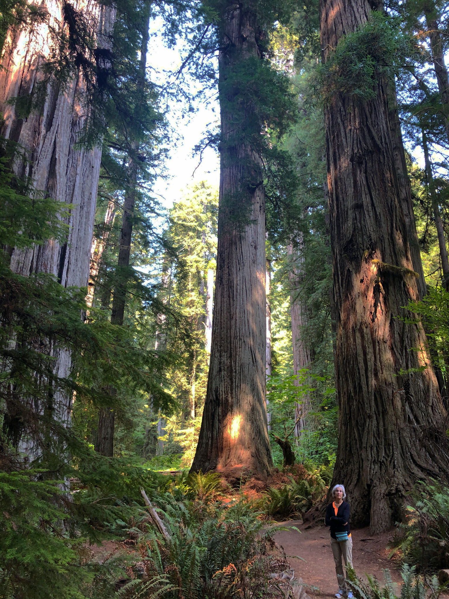
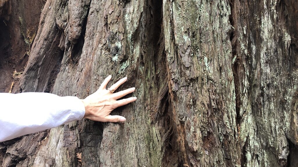
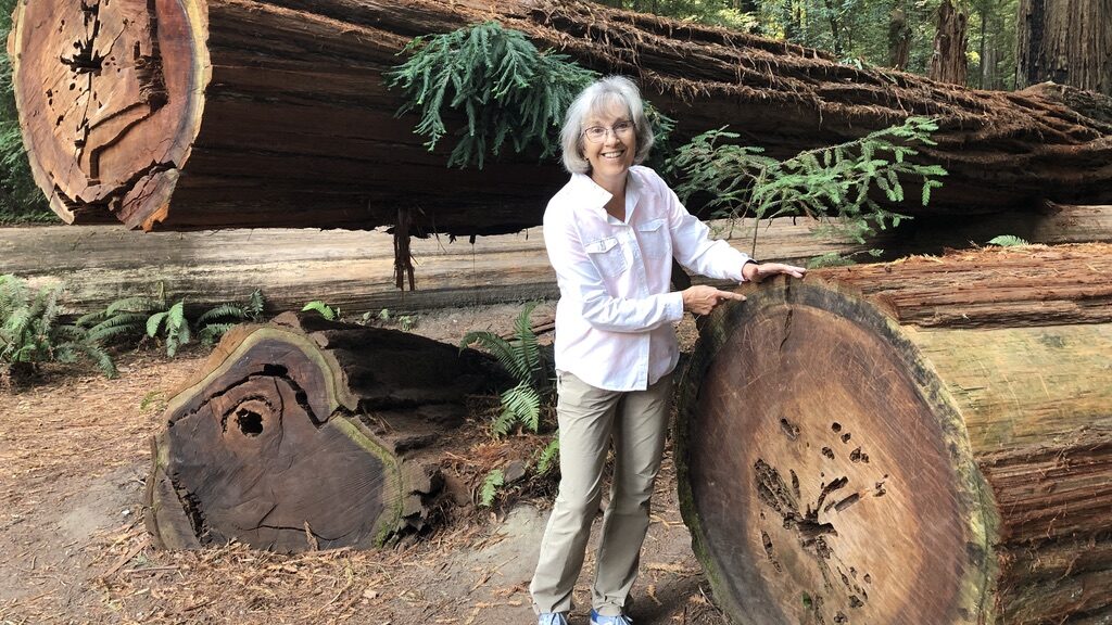
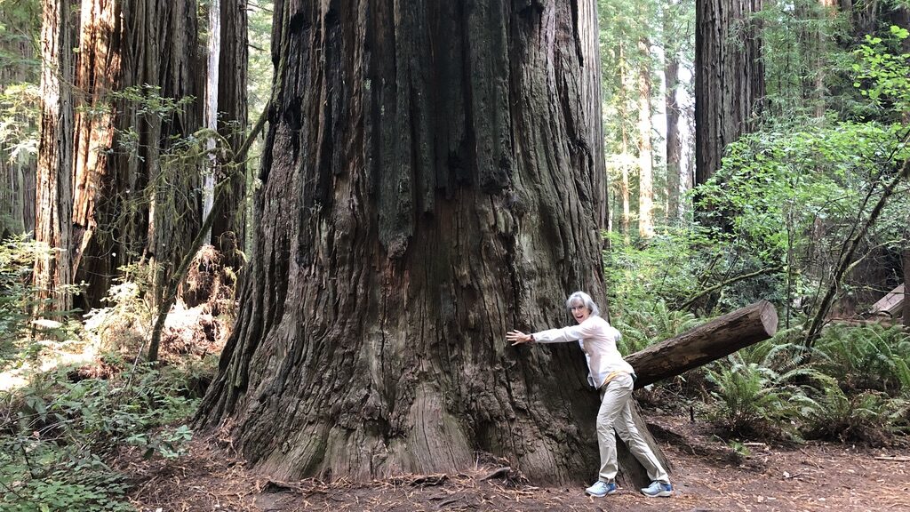
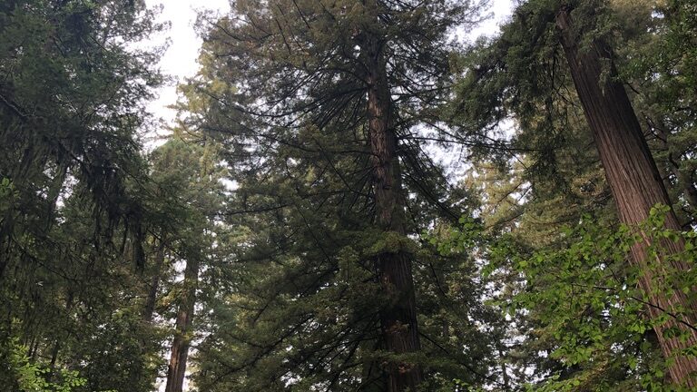
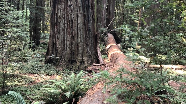
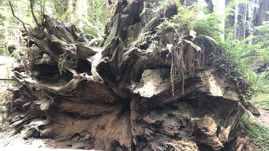
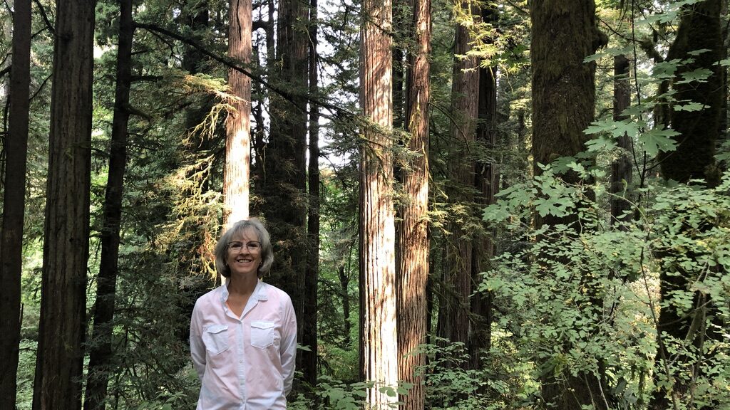
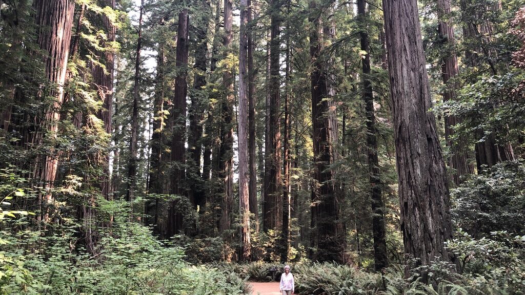
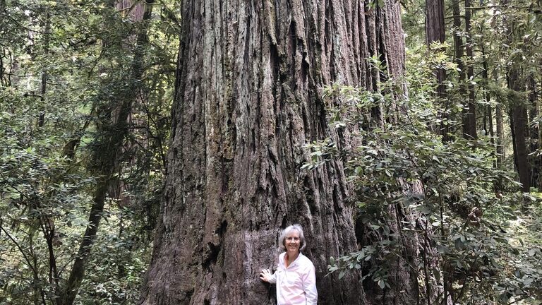
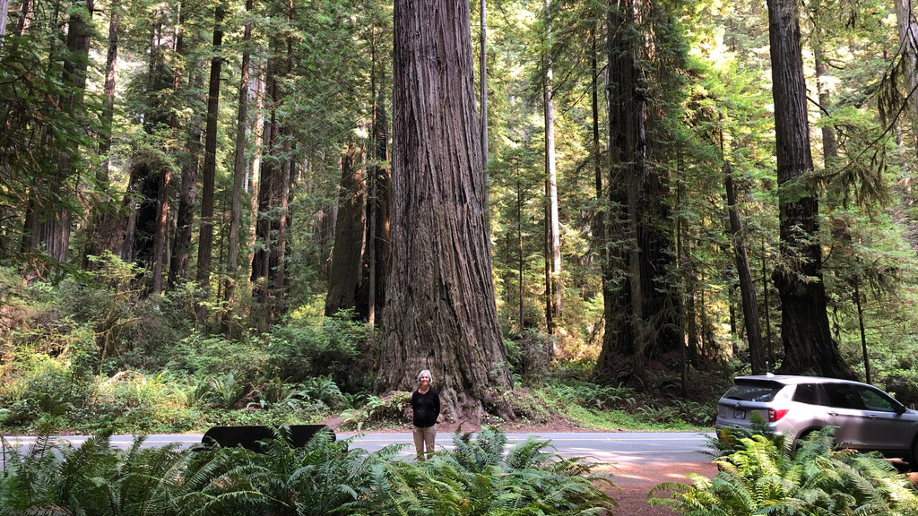
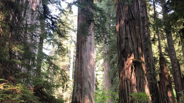
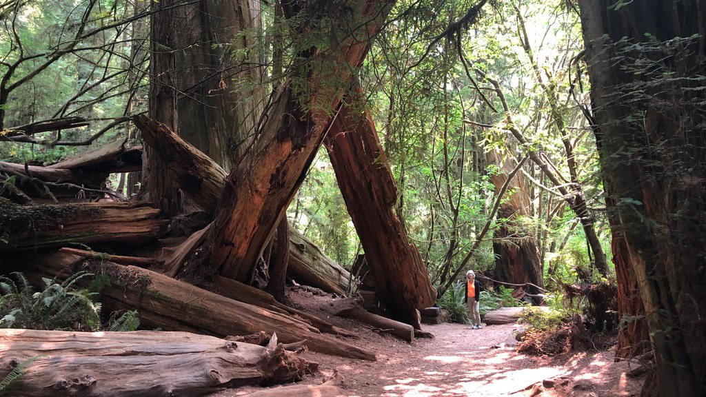
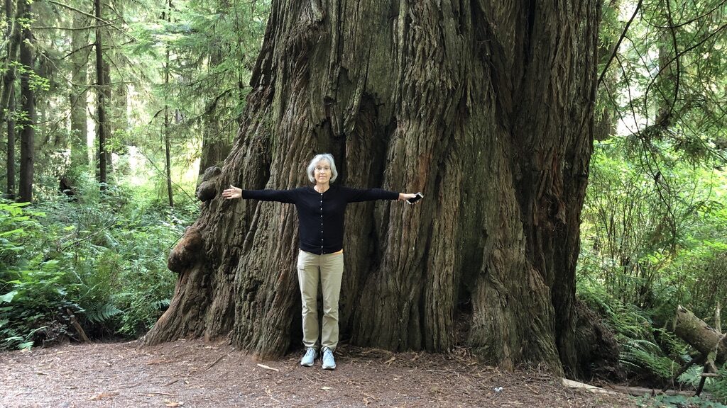
From Montana, we headed to Oregon to meet up with our friends, Deb and Steve Thompson. In Oregon our travel plans changed due to fires in northern California. We diverted along the coast instead and saw the awesome Redwoods. I just love these trees!

The next stop was a few days in Death Valley – truly one of the hottest, driest places I’ve ever seen. In spite of the heat, we did manage to play golf there a few times at the oasis. After that it was a beautiful drive to Bryce Canyon, Moab and down to Tuscon. By the time we’d returned to Florida we’d traveled just under 10,000 miles….most of which Tim drove!

Future Plans
We continue to hope for travel opportunities in the future. We are vaccinated, and recently had our passports renewed. We hope to go back to Europe next summer – Ireland, Iceland, Greece, Italy, Spain and Portugal– if you are interested in traveling any part of that with us, go to our travel website and check it out. Better yet, email Tim or me so we can include you in our planning with travel agents.

Merry Christmas and Happy New Year!
Bryce Canyon National Park

Bryce Canyon

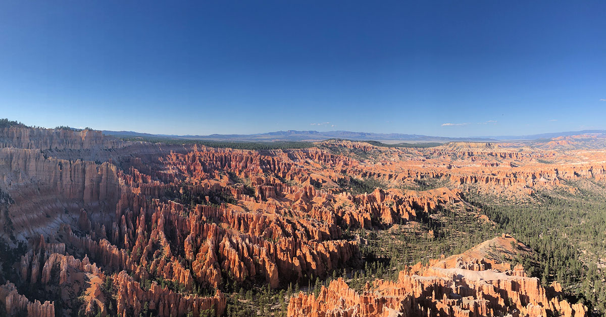
Bryce Canyon National Park gets some of our highest marks among the National Parks we’ve visited. Our 2021 visit only enhanced our opinion of the park.

Driving in from Death Valley, we arrived early enough in the afternoon to enjoy a quick drive into the park. The late afternoon visit refreshed our memory of the sharp, colorful spires known as hoodoos. It was great to be back.

Our friends, Deb and Steve, had arrived the previous day. After dinner, we made plans to head back into the park early the following morning. Wanted to catch the morning light and take a hike before it got too warm.

Navajo Loop Trail

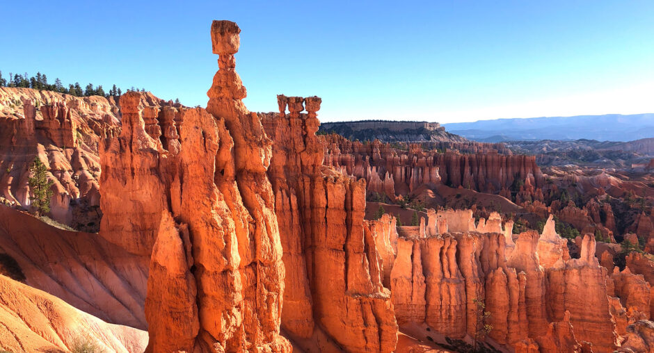
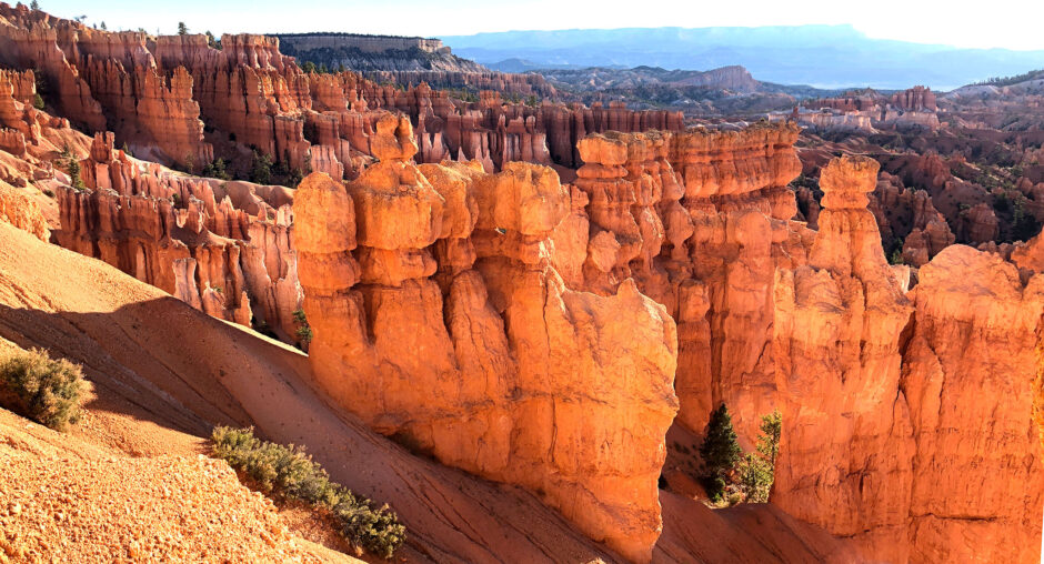
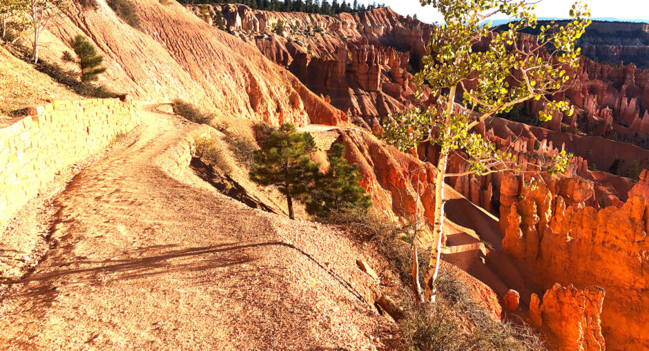
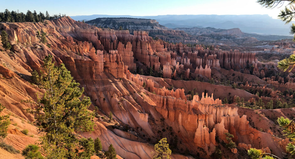
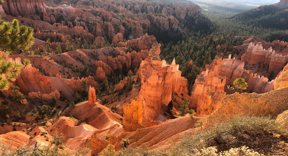
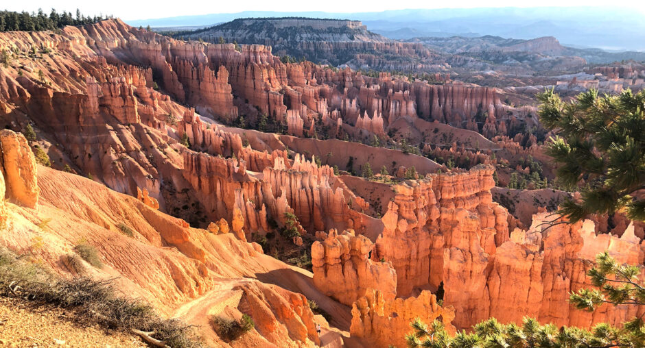
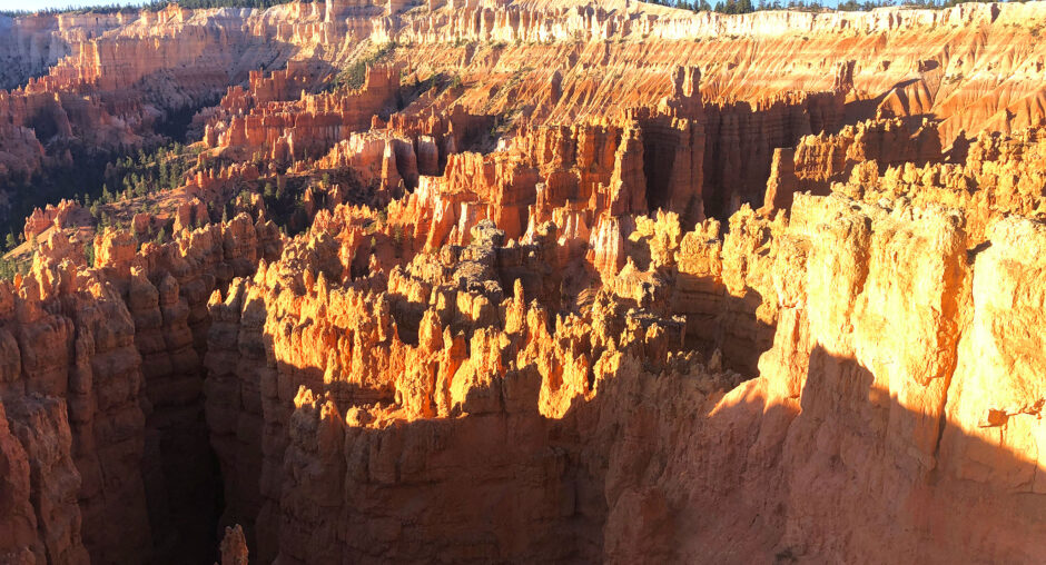
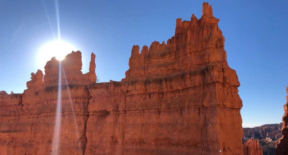
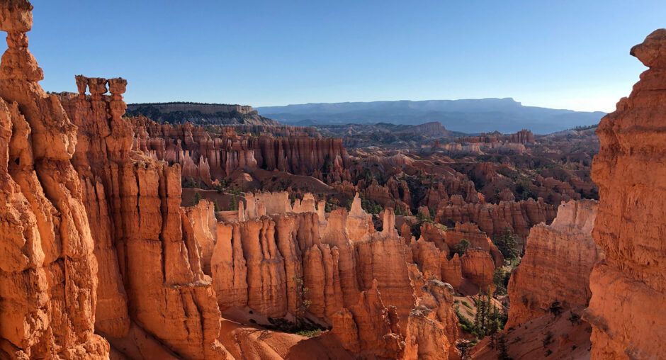
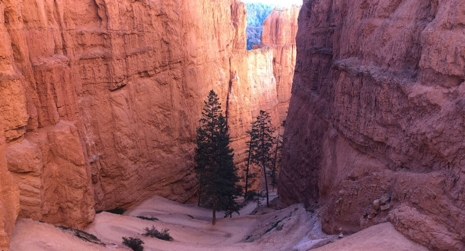
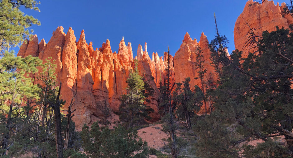
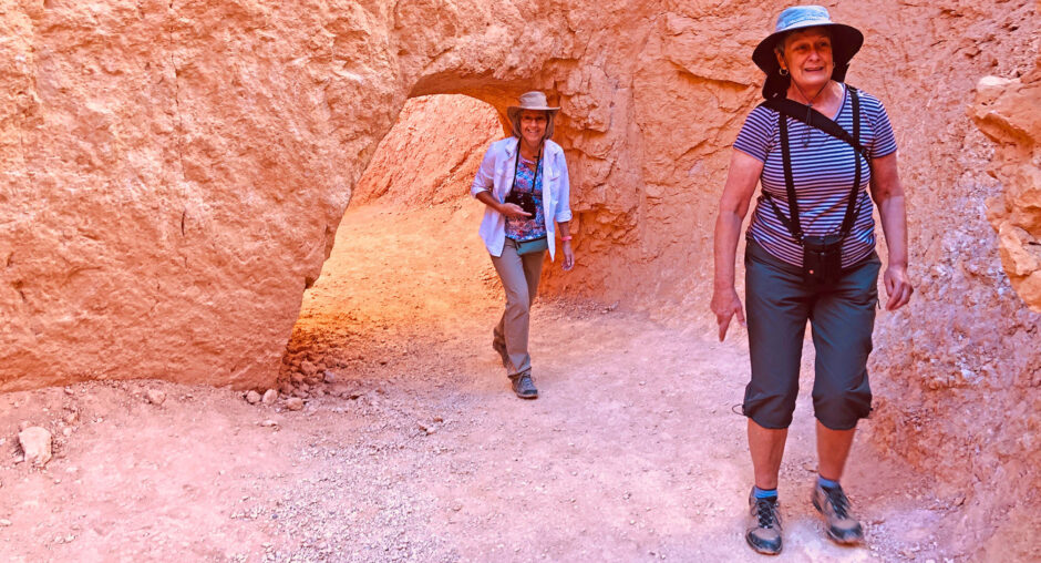
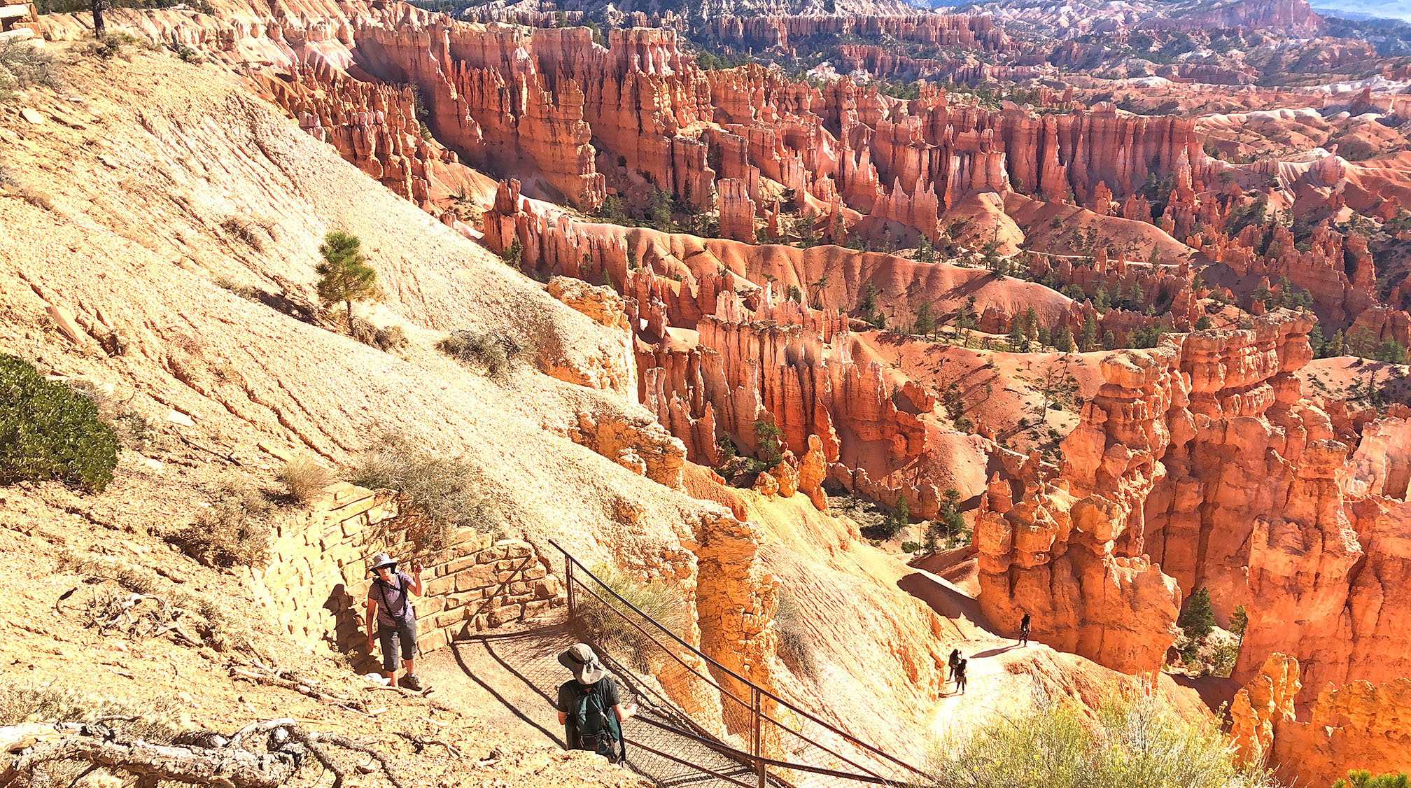
As planned, we headed to Sunset Point under clear skies around 7:30 AM. The low angles of sunlight illuminated the towering spires and hoodoos and produced contrasting shadows. That lighting provided great photography opportunities with a wonderful palette of warm colors. Once we took ‘more than enough’ pictures we headed down the Navajo Loop Trail.

Red rock formations and hoodoos against a clear blue sky.Scenic view of tall, layered red rock formations under a clear blue sky.Red rock formations in a desert canyon under blue sky.Sunlit orange rock formations in a desert canyon landscape.Scenic hiking trail along a rocky cliff with autumn trees.Sunlit hoodoos and rugged cliffs in a vast desert canyon.Aerial view of orange rock formations and autumn forest.Sunlit hoodoos at Bryce Canyon National Park under a clear sky.Sunlit hoodoos in a canyon under a blue sky.
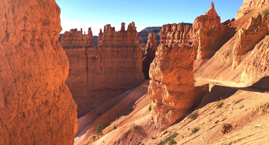
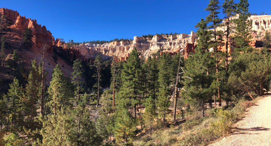
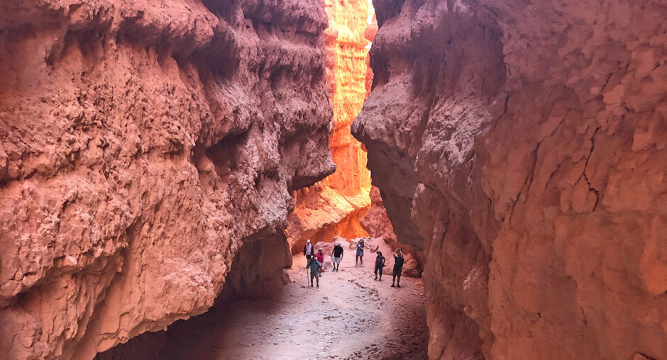
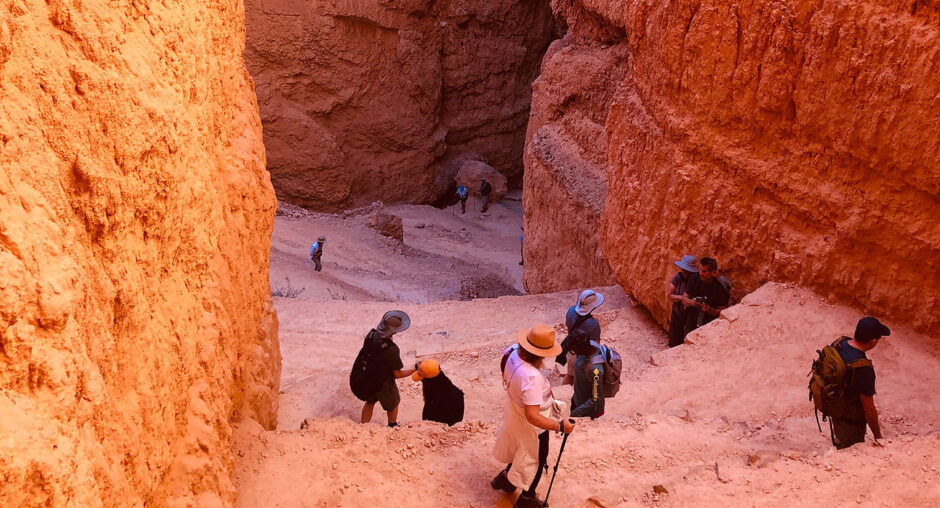
The Navajo Loop, starting and ending at Sunset Point, consists of two primary segments. The eastern trail descends down past Thor’s Hammer, for a bit over 1/2 mile. After dropping about 515′ in elevation, the trail continues around to the west and climbs through “Wall Street”, back to Sunset Point.

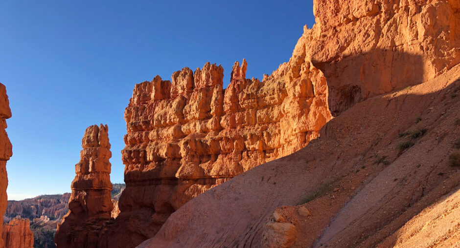
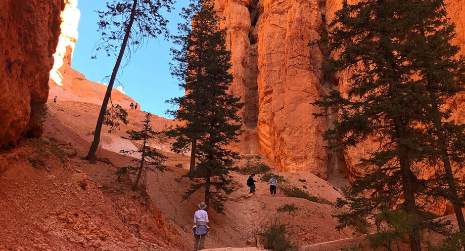
The initial trek down the trail took us past plenty of colorful limestone hoodoos. The morning sun was quite warm, but after about 1/4 mile we were in the shade, descending through a high walled canyon of color, and some impressive trees.

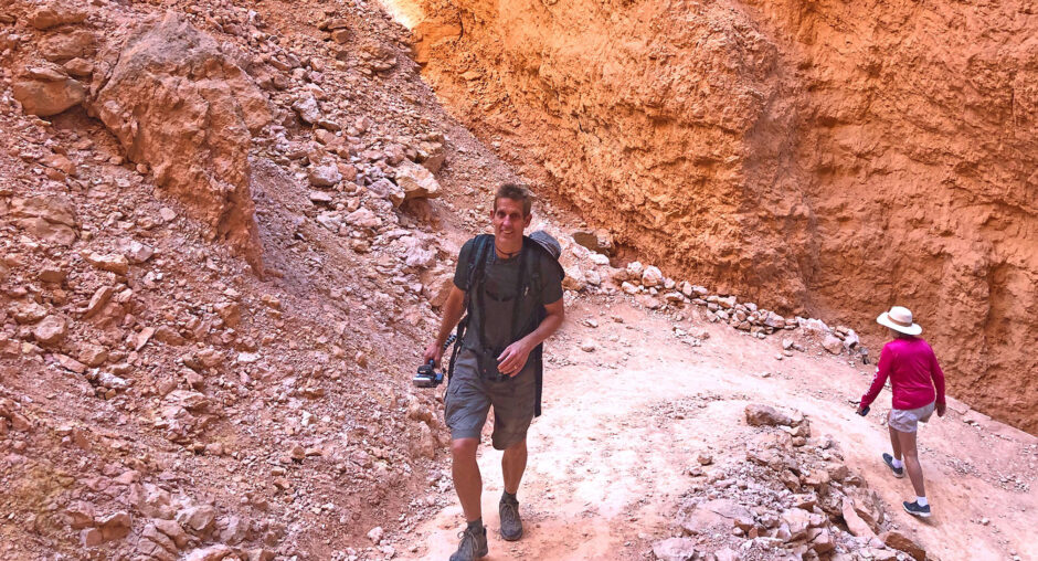
We were glad we’d elected to climb back up through Wall Street because that portion of the trail was shaded nearly the whole way. Wall Street is at times very narrow and mostly very steep. The trail was well maintained, and it was a completely different experience than the eastern descent. According to the Park’s website, the Wall Street section is closed during the winter. So plan to visit between April and mid-October.

Sunlit red rock formations under a clear blue sky.Sunlit red rock formations under a clear blue sky.Sunlit rock formations in a vast desert canyon under a clear blue sky.Tall pine trees growing in a narrow canyon with orange rock walls.Hiker walking along a trail surrounded by towering red rock formations and pine trees.Scenic view of pine trees with a rocky cliff under a clear blue sky.Two hikers walking along a forest trail with a dog on a sunny day.Orange rock spires rise against a clear blue sky with trees below.Hikers exploring a narrow canyon with striking red rock formations.Man hiking through a rocky canyon holding a camera.Tourists exploring a deep red canyon with steep walls.Two hikers exploring a rocky desert trail under a natural stone arch.
Sunset

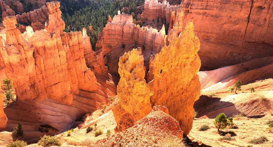
At sunset, we drove to Bryce Point and Paria View to explore the sunset colors in the park. Both locations were nearly empty of visitors and yet gave us beautiful views of the park. Visiting the park early or late in the day provides, what I think, are the best views. There are more vivid colors and the shadows provide so much more depth to the carved and colorful limestone spires.

Queen’s Garden Trail

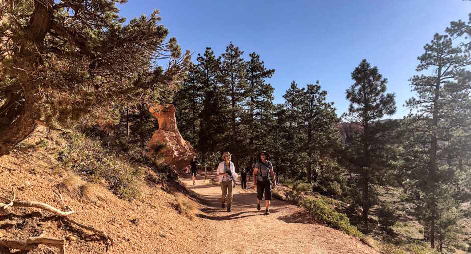
Over three days exploring the park we got plenty of hikes in, and I’m guessing that Julie managed to reach 10,000 steps each day. On the last day, Julie, Deb, and Steve took the Queen’s Garden Trail down into the Amphitheater. I took my camera and remained upon the rim.

The trail has a lot less shade than other treks. As a result, my three companions climbed up the last of the trail looking pretty hot and tired. The good news is that I was back at Sunrise Point to grab photos of each as they arrived back at the rim!
A lush green valley with a river flowing through mountainous terrain under a cloudy sky.
Deb and Steve climbing up from Queen’s Garden Trail
If you have never visited Bryce Canyon, add it to your list of places to visit. For those who have been there previously, consider going back again. This is one great National Park.

Redwood Parks

A lush green valley with a river flowing through mountainous terrain under a cloudy sky.It was the middle of September when we headed south out of Oregon for Redwood National Park. We diverted from Lake Tahoe because of the wildfires threatening that resort community. Looking for someplace else to explore, we quickly focused on the Redwood forests of Northern California.

Jedediah Smith Redwood State Park was our first destination as he headed for Stout Grove along the Smith River. Turning off Highway 199 just before Hiouchi, CA, we followed Douglas Park Drive until it turned from asphalt to dirt. We were now in the state park.

A lush green valley with a river flowing through mountainous terrain under a cloudy sky.

Stout Grove

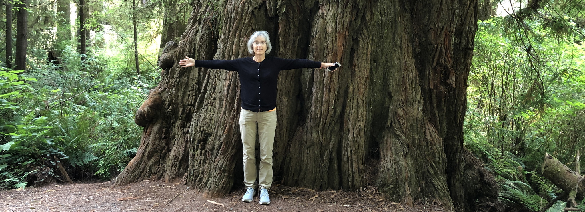
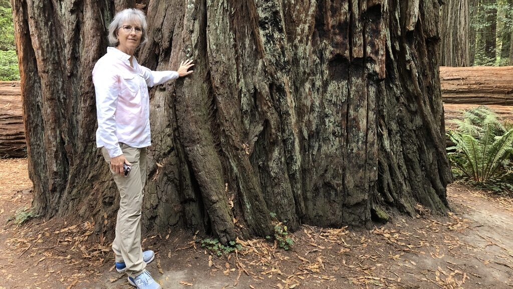
From the start of the dirt road, it was only 1.2 miles to the turnoff for the Stout Grove Trailhead. We headed down the trail and into the grove. The peaceful quiet of the grove set the tone for the trek. This is a very easy and relatively flat trail other than a short descent in and climb out. The immensity of some of these redwoods left us in awe. Some were as big around as our car.

It took about 30 minutes to walk the circular path, and soak in the quiet and unexpected size of these old-growth trees in this grove. Then we climbed back to the parking area and moved on. We headed west through the park on a dirt road. Unfortunately, we found that road was blocked about two miles in due to nearby wildfires. So, we backed-tracked to Highway 199 and continued west to Crescent City.

Redwood National Park

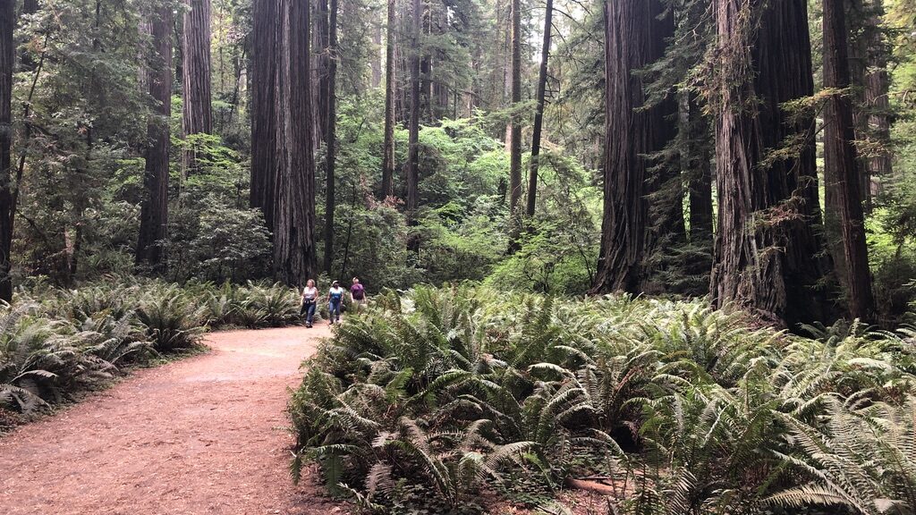
Driving south along US-101 and the Pacific coast, we quickly entered Redwood State and National Parks. Just south of the Klamath River we turned off 101 onto the Newton B. Drury Scenic Parkway. If you get to Northern California, you have to take this drive. The parkway traverses miles and miles of old-growth Redwoods. We stopped several times, got out of our car, and just walked among these giant sentinels.

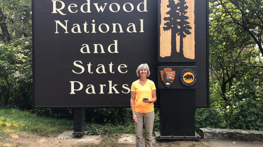
  • Person standing in front of Redwood National and State Parks sign.
    Redwood National and State Parks
Just feet off the roadway you’re immersed in the quiet, peaceful setting of the forest. The soft ground is deeply carpeted with pine needles and absorbs the sound of human footsteps. The scent of redwoods, cedar, and eucalyptus saturated the air. As we looked up at these beautiful giants, we tried to fathom how we could capture the experience that saturated our senses.

Oregon – A Remote Destination?

Oregon

Having lived and grown up in Upstate New York, we see Oregon as a distant place.

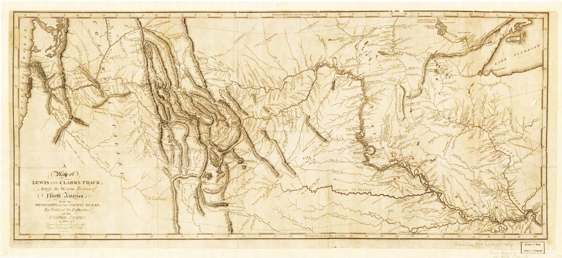
Sure, we learned about the state in grade school. Lewis and Clark trekked from Missouri, across Kansas and Nebraska, and then followed the Missouri River to Montana. There they crossed Idaho and followed the Snake River to the Columbia River. From there they just rode the Columbia River to the Pacific Ocean.

Lewis and Clark

That trip was the start of the Oregon Trail. (Actually, only part of the Lewis and Clark Trail was used in the Oregon Trail, but that’s another story). What I found interesting was that the westward expansion to Oregon was driven, in part, by the declaration of the Monroe Doctrine and the concept of Manifest Destiny.

You’ve got to admit that, while you may not have heard those terms in many years, you can still remember learning (and possibly forgetting) about them in school. Well, don’t worry. This won’t be a rehashing of 5th Grade.

Exploring Oregon

We found ourselves in Oregon visiting Julie’s college friend Deb, and her husband Steve. While it is true that they live in far-off Oregon, they’re actually pretty normal, and nice folks. After our personal trek across Montana, we followed the Lewis and Clark trail along the Columbia River to their home, just outside Portland. There we relaxed for a few days before heading to the Oregon coast.

The first thing you need to get used to on the Oregon coast is the weather. While it was close to 90° in Portland, along the coast, it was a cool 65°. We spent three days in Lincoln City, and it was sunny, and cool every day. The mornings had bands of low-slung clouds blowing in off the ocean and keeping things cool.

Just inland, there are hills that rapidly rise from the coast. As those clouds get pushed up the slopes, they magically disappear among the fir and spruce. Yesterday morning, we followed the clouds up those hills to a lovely trail – Drift Creek Falls. The trailhead is located about 10 miles down Forest Service Road 17. That’s an apt description for winding through several backroads to get to an unmarked road that seems to lead to nowhere.
A lush green valley with a river flowing through mountainous terrain under a cloudy sky.
The trailhead has parking for about a dozen vehicles. A few miles before the trailhead, I pulled into a turnout and let an impatient driver pass. Steve commented, “He’ll probably get the last parking spot.’ And Steve was right!

We pulled in and there was the car that passed us. No open spots remained. Fortunately, within a minute someone left, heading back to civilization.

The trail itself was a nice experience. Obviously, there is a waterfall, but there’s also a suspension bridge and just the experience of hiking through the Coast Range forest. The elevation change is over 500′, with the first half going generally downhill towards the falls. Then you have to hike mostly uphill back up to the trailhead. The well-maintained trail makes the climb fairly easy.

A lush green valley with a river flowing through mountainous terrain under a cloudy sky.

Quiet Wonder

Hiking through the quiet forest of spruce and fir trees is wonderful. Moss hangs from many of the branches and the scent is calming. The sky was mostly clear, but the depth of the forest lets in little sunlight. The height the trees reach is incredible. I can’t even begin to guess, but they looked to be over 100′ tall.

The suspension bridge is right at the falls. Not like the Golden Gate, but not like Indiana Jones either. It only swayed when some knucklehead kids were screwing around as I was crossing… (Kids!) We walked over the bridge and headed out pretty quickly. There were several large groups without masks scrambling around at the viewing area for the falls. We headed back about ½ mile, stopped at a bench, and ate lunch from our day-packs.

On the off chance that you ever make it to distant Oregon and the Oregon Coast, try and fit some time into your schedule to hike to Drift Creek Falls. At 3.2 miles, this is a relatively easy trek that we think everyone would enjoy.

  • bridge
    Drift Creek Falls Suspension Bridge

We left the trailhead in the early afternoon. The sky was partly cloudy and the temperature was about 75°. As we headed down the Forest Service road towards the coast we watched the temperature drop until it settled at 65°. All in all, it was a real nice experience.

Glacier National Park – Day 2

Glacier National Park – Peaks and Valleys

On our second morning in the park, we woke to a much nicer day. The clouds were mostly gone, and the only hints of rain were the remnants left on the car, and in the parking lot puddles.

With priorities being what they are, we headed out of the park and grabbed our breakfast burritos and coffee. It was still pretty cool as we headed up the Going to the Sun Road. The hot coffee and breakfast burritos were just what we needed as we headed for Logan Pass.

This time, we bypassed the stops we’d previously been to along Lake McDonald, hoping to reach the vistas clear of yesterday’s clouds and rain. Our climb towards Logan Pass rewarded us for our decision to see the road again. We had wonderfully clear skies and incredible views. We made multiple stops and grabbed plenty of photos.

A lush green valley with a river flowing through mountainous terrain under a cloudy sky.
Looking back towards McDonald Lake

Just after navigating ‘The Loop’ switchback, we have a clear view of the valley we’d just driven up from Lake McDonald. By this time we also had some clouds starting to build on the western side of the mountains.


Once we cleared Logan Pass, the skies cleared and we had great views of the impressive peaks, valleys, and lakes. Sadly, most of the glaciers have retreated over the recent decades. Today they are just shells of their former selves. We spotted several for the road as we traversed the park. Had we the time, inclination, and maybe some camping gear, we could have taken one of the many hikes back to the glaciers.

Recommended

All in all, Glacier National Park turned out to be a fantastic experience. We’d highly recommend a visit. Suddenly, it’s time to hit the road again and head further west!

Glacier National Park – Day 1

It was our wedding anniversary when we arrived in Glacier National Park. One thing that everyone needs to know about Glacier National Park is the cell service. It is somewhere between non-existent and abysmal. For most of the park, expect to see No Service on your mobile device. As far as WiFi goes, forget about it as well. No place has WiFi (or WeeFee as one local pronounced it). After two days in Grand Teton National Park with no cell and marginal WiFi, we were prepared for several more days cut off from technology.

Breakfast
On our first morning, I arose early and headed out in search of coffee and breakfast. The line for coffee was incredibly long at one spot- only one spot. No place had breakfast. I gave Julie the news and we headed out. In West Glacier, just outside the park, we grabbed a couple of breakfast burritos that were amazing. Potatoes, green peppers and onions, cheese… and of course scrambled eggs. Great coffee to boot!

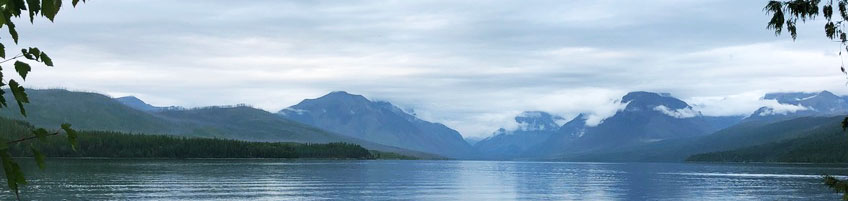
Munching on the breakfast burritos, we drove back into the park and onto Going-to-the-Sun Road. The weather was overcast and about 50 as we started. We made a few stops along the lake as we headed north. Every time we got out of the car we were greeted with the fresh smell of pine.

Misty mountains reflecting on a calm lake under cloudy skies.
Lake McDonald

Initially, our intent was to reach the continental divide at Logan Pass – 32 miles at an elevation of 6646′. Going-to-the-Sun Road starts at the south end of Lake McDonald, slowly gaining elevation along the east side of Lake McDonald.

Along the lake
McDonald Falls on Avalanche Creek was a nice first stop for us. Quiet and scenic, we relaxed and shot a couple of photos. From that point, the road pretty much follows McDonald Creek, getting steeper after the Avalanche Creek picnic area.

Person fishing by a rocky river surrounded by dense forest.
Julie at McDonald Falls

After we passed over Avalanche. Creek, we started to get some rain, and wisps of clouds started drifting lower. This was not great for sightseeing, but we were in explorer mode. Before approaching Logan Pass, we had to navigate ‘the loop,’ a hairpin switch-back with a perilously sharp drop to the left as you approach.

Weather closing in
By this time, we couldn’t see the tops of the mountains as they were shrouded in a heavy layer of clouds. Below that, the winds and rain had picked up and those wisps of cloud were now denser, and rapid-moving clouds as they pushed up the west side of the peaks.

From ‘the loop’, and until we passed the ‘weeping wall’, Julie often chose to ignore the view because of the steep drop outside her window, down to the valley floor far below. I stopped several times and tried to capture the clouds and the terrain, but this wasn’t great photography weather.

A foggy mountain road with a long line of vehicles.
Dark clouds blowing past

After the clouds closed in, the temperature dropped, and the rain really picked up. Suddenly we found ourselves at Logan Pass. The temperature was near 40, and the wind was driving a steady rain. Because of COVID, the indoor section of the visitor center at Logan Pass was closed. Also, because of the weather, no one was hanging around outside to ask any questions. 90% of the ‘visitors’ were simply making a mad dash to the restrooms and then back to their vehicles.

Heading East
Surprisingly, as we headed further east from Logan Pass, the clouds and rain diminished. It was still sprinkling, and cloudy when we reached the Jackson Glacier Overlook. The receded Jackson and Blackfoot glaciers, visible from that point, were a disappointment. (Global warming is causing glaciers to retreat)

Our next stop was at Sun Point Nature Trail. After a short walk down towards Saint Mary Lake, we came out on a promontory with an incredible view south, across the lake. We could clearly see a large hanging valley across from us and peaks to the east and west. It was beautiful. (It was also cold with a cutting wind)

Scenic mountain lake view with pine trees and rocky foreground.
Saint Mary Lake

We continued east on the highway, the views were magnificent. We exited the park at the Saint Mary Visitor Center, an considerably less busy location compared to West Glacier. The Saint Mary entrance is located roughly halfway between the southeast corner of the park and the northeast corner at the Canadian border. The 29 miles between the Saint Mary entrance, and East Glacier Park, at the southeast corner of the park, was an interesting drive.

Outside the Park
Warnings to ‘consider alternative routes’ and ‘intermittent pavement’ are appropriate. The 8′ reflector-tipped markers off the sides of the road are stark reminders that this area gets a healthy allocation of snow in the winter. (Really? Do you need markers 8′ off the ground?!?) I should also mention that for 86 miles between Saint Mary and West Glacier we saw only a single gas station in East Glacier Park.

All in all, this trip took us five hours, less one 30 minute nap somewhere in the Flathead National Forest where we pulled off Hwy 2. Tomorrow the weather is supposed to be better, except for the snow. Hopefully, we can provide a better narrative of Glacier National Park.

Welcome to northern Montana in August.

Bike Trip in Steamboat Springs

Steamboat Springs, Colorado

This morning found us renting e-Bikes for a back-country road trip. At home, Julie rides her bike every day. Me, I get saddle sores just thinking about riding a bike. Regardless (or irregardless for some of my friends), we rented a pair of e-Bikes and headed out, map in hand.

A cyclist stands with mountain bikes near a scenic informational sign.These bikes were very nice, Trek Rail-5 e-Bikes. They handle paved roads and paths fine and are very stable on ‘gravel‘ roads. That was good, because our route was 28 miles across paved and gravel roads. However, I was more interested in the power assist from the bikes because we were climbing over a series of ridges with elevation changes of over 2300’.

The bike has four power-assist settings. ECO, Tour, EMTB, and Turbo. ECO gives a little boost, but Tour is the setting for flat to moderate hills. EMTB stands for (a guess) E-Mountain Bike. Those pesky little hills won’t stand a chance at this setting! Then there is Turbo. The guy at the bike rental shop told us, “You won’t need Turbo mode, but you can try it out if you like.”

Heading Out

The Trek is a big heavy bike compared to what we’ve ridden in the past. We walked the bikes across the street and then started off riding the bike. Within a ¼ mile we were both comfortable on the bikes and turned onto Twentymile Rd. There were some inclines, but the bike handled them with no issue. Until mile 6.

The road slowly became steeper, and then precipitous. We switched from Tour to EMTB and benefitted from the power assist. Even with the bike helping us, it was a long three-mile climb. This is about the point where I started asking Julie, “Tell me again, why did you want to do this?” Well, we took a well-deserved rest at the top of this hill after climbing ~600ft.

The First Real Hill

Leaving our first rest stop, we began a fantastic 1-mile descent. Whoa! We were flying down the slope at over 35 mph. On a bike, that’s a rush! But then it was back to climbing another hill. This next climb was four miles long. Argh! It was here that we discovered the power of TURBO!

By now we were on a dirt road; the map claimed it was a ‘gravel road’. Between the road surface and the grade becoming pretty sharp, Julie and I were both struggling. Even with the power assist set at EMTB, it was rough going. With my longer legs, I was able to make pretty good progress, but Julie started falling back. “You go on ahead”, Julie breathlessly told me with just a little self-pity in her voice. So I knuckled down and pushed ahead.

The climb continued to torture me. I looked back several times and Julie was still there, but falling further behind. I focused and pushed on. Unexpectedly, I heard bike tires behind me. Suddenly, Julie was beside me…, passing me! (What the heck?!?) With a big smile on her face, she yelled ‘Turbooooo‘ as she passed, and continued streaking up the hill. She had discovered the power of TURBO.Smiling woman in orange shirt and helmet on a mountain trail under blue sky.

From that point on, whenever we hit a hill of any measure, we selected TURBO and attacked the hill. When we passed riders on ‘regular’ bikes struggling up the hill; we just apologized and kept going. After the last hill, we’d passed above 7200ft and it was mostly downhill from there.

We had multiple rest stops, we drank a lot of water. There were also a few map stops to make sure we were on the right route. Our time for the 28-mile trek was somewhere around 2½ hours. We really enjoyed the trip and enjoyed the eBikes even more. We’d never had made it without them.

Time to hit the hot springs.
Cycling route map with elevation profile showing a challenging ride.

On our way

This morning we woke up in Colby, KS, about 1600 miles into our summer swing across the western United States. With Colorado being our first ‘real destination’, we’ve just been pounding out the miles so far.

Black and white sketch of a basketball court with players and a hoop.
Ledgeview Elementary

From the highway, we only get a glimpse of the country we pass through, but I find it curious that a great deal I remember about the states came from 5th grade. Back in the day, we had to learn the names of the states and their capital cities. We also learned the various states’ history, economics, and development. Absent what I learned in Ledgeview Elementary School, these are a few of the interesting observations from the front seat of our SUV.

Georgia

Forsyth, Georgia. We spent our first night in this small town just north of Macon, Georgia. Forsyth has our vote for Smalltown, USA. The center of the town is what you’d expect with shops and cafes. Outside of Main Street, the roads are lined with beautiful trees. They claim the oldest Magnolia tree in the state of Georgia.

South of Atlanta, we passed a very large solar farm that looked to be nearing construction completion. It ran along I-75 for close to a mile and stretched east into the hills. We never thought of Georgia as a location for solar energy, but it IS just north of Florida, the Sunshine State. We’re happy to see solar expanding.

It was late in the afternoon, and we were getting tired as we left western Tennessee and entered the tip of Kentucky. Here we passed through Paducah, Kentucky – a place I know of, but likely only from 5th grade. Pasucah is a city I’ve never really thought of traveling past. Sitting at the confluence of the Ohio and Tennessee rivers, I can see that Paducah would have been an important city in the 1800s. And suddenly it was in our rearview mirror.

Here Comes the Rain

Just east of St Louis, Missouri the skies darkened, the temperature dropped and we were entertained by distant, long strokes of lightning from high clouds. The strobe lightning led the front of a rainstorm as we headed west along I-64. Then, suddenly the rains came. Heavy, dense, dark, pounding rain. We slowed to 40 MPH with flashers on, our wipers could barely keep up.

After about 15 minutes of white knuckle driving, we finally drove out of the rain. It was gone nearly as fast as it had initially attacked us. From well outside St Louis, we caught a distant view of the 630 ft St Louis arch. If it hadn’t been raining so hard, we might have detoured to get closer. After all, it is “Missouri’s tallest accessible building, the world’s tallest arch, and the tallest manmade monument in the Western Hemisphere“, at least that’s according to Wikipedia.

Kansas

Yesterday we experienced what I call the two faces of Kansas. Eastern Kansas has rolling hills and trees. It isn’t lush, but it’s not dry either. Then, about halfway across the state, most of the trees are gone and the hills are not as high. Heat, corn, wheat, and wind – that’s what we saw and felt. Fields that seem to stretch for miles were waiting to be harvested.

Wind turbines generating renewable energy in a vast field.
Thank goodness for air conditioning! Wind turbines generating renewable energy in a vast field.The outside temperature was over 100 for most of the way across western Kansas on I-70. In addition to corn and wheat, we passed vast farms of wind turbines generating sustainable electricity from the ever-present wind. Sitting here at a desk in our motel I’m looking at a picture of an old prairie windmill. The link to the modern behemoths stretching across the windswept prairie is not lost on me.

Well, it’s time to hit the road again. Next stop, Colorado,

Travel Planning

Looking Ahead
Well, it’s mid-July and right now we’re working on travel planning for 2022 and 2023. As I’ve mentioned before, the COVID Pandemic has put a crimp on our travel plans.

When we retired we’d envisioned 4-6 years of traveling ¾ of the year. The remainder of the time we’d planned to spend in Florida or with family. Grandma-Grandpa Camp with the grandkids was an absolute requirement every July as well.

A lush green valley with a river flowing through mountainous terrain under a cloudy sky.COVID-19 Impact
Well, COVID forced us into changing our plans. In early 2020 we were in Florida when it became apparent that COVID-19 was going to have a significant impact. That year should have begun with a trans-Atlantic cruise followed by a couple of months in Europe. Well, that didn’t happen.

The fall of 2020 called for a trans-Pacific cruise to Japan, China, and South Korea. Then we were spending 3 weeks exploring Japan and then lounging in Hawaii on our way back to the US. Again, that didn’t happen. Instead, we spend 2020 huddling in a rented house in Bonita Springs, Florida. But, hey, 2021 was going to be the year to look forward to…, right?

Both Julie and I got our vaccines in March; Florida has done a great job distributing the vaccines. Unfortunately, a great deal of the rest of the world has lagged. Most of the planet lacked the technology and funding to undertake an Operation Warp Speed type effort to develop and distribute vaccines.

Today we relax in the early part of 2021’s second half. The outlook is good for large parts of the US, and we’ve got a trip scheduled for August-September across the Western US. We’re hitting many of our favorite national parks, and some new ones that we’ve not experienced before. We’re also starting the 2022-2023 planning process.

Planing Ahead
When we retired, we quickly realized that the planning horizon for travel should be at least 12 months out. You could work with a shorter planning horizon, but rental and hotel selections were more limited and often the preferred tours were also booked up. So now is the time to start planning for the summer of 2022 and beyond.

Sunset casts pink hues over jagged mountains and a reflective lake.Early 2022 looks questionable for international travel, but we’re booked to trek across Argentina and Chile in Feb-Mar 2022. We’re giving the plan a 60% chance of happening. After that, Iceland, Portugal, Italy, and Greece are top prospects as we plan the next 24 months. You can read about our planing at our website.

The travel plans are in a constant state of flux right now as we’re still gathering information. If you have travel experiences or ideas, send me information. The more information we have, the better our adventures will be.

What to do?

In the last post (Internet Threats) I covered some real threats at a high level. Now let’s talk about what you can do to reduce the threat.

Internet Browsing
Regardless of the browser you use, IE, Chrome, Safari, or something else, you should NEVER use the browser’s “remember my password” feature or save any personally identifiable information you enter on a form. I know it is a great feature, you never have to remember your password because the browser remembers them for you. The big problem is that anyone with access to your computer has access to those same passwords.

To reduce the risk of exposure to malicious files or programs, Set your web browser to block pop-ups. You can always create an exception for some sites on a case-by-case basis. This will not only make your browsing more secure, but it will make your experience more pleasant.

If you play online games or download free software, be very careful. Spyware may be bundled with those programs. When you install the program, you may be installing something much more dangerous than you bargained for.

Be aware of the web browser address bar. That tells you what site you are on. If the address changes unexpectedly (like from Bank of America to Hacker’s Bank of Russia) or if you click on a link and are taken to an unfamiliar address, watch out!

Many ads track you or may even contain malware. Install an Ad Blocker browser extension (AdBlock) to block malicious ads. If you want, you can add additional tracking and malware filter lists to increase your protection.

Avoid clicking on links in general. Ads, offers, articles, etc. These are all potentially dangerous. Instead, note the information from the ad or article and use Google to search and see if it is something that you really want to see. On the other hand, if you’re on a mainstream site (CNN for example) you can trust links for news or similar links. But be cautious on ads and offers that send you to a third-party website.

Email
This is a tough one, I know. We all get those juicy and tempting messages in our email inboxes. You have to be strong and delete the messages that come from someone you didn’t expect. Whatever you do, NEVER click on a link in an unexpected email. Just clicking on the link can have you installing malware or spyware on your computer. Email is emotionally inviting for many, but it is a dangerous and high-risk tool that hackers love.

Even if you get an email from someone you know, think twice before opening any attachments. Email is so easy to spoof. (‘Spoofing’ is sending an email that looks like it is coming from someone you know). If you’re expecting the attachment, fine. But if it’s unexpected… think twice… then think again.

AntiVirus Software
This is part of the cost of owning a computer. You MUST use anti-virus software if you’re using your internet browser. Sure, that software costs money, but the risks you accept without it may be far beyond what you think. Think of what kind of transactions you make on that computer. Web banking, shopping? How many times have you input a credit card number? How many login accounts do you have? Consider the risk.

Passwords
Here is another tough topic. Passwords. I strongly recommend a password manager application. I use 1Password, one of the top-rated applications in this category. Rather than allowing the browser to remember your passwords, the password manager remembers them. Better still, it will generate secure passwords and remember them for you. What do you think is a better password – fluffy1973 or ?M7hUBhJkRQX4nDczX4p?

1Password encrypts the password before storing them and works across pc, phones, and tablets. You just have to remember one master password. Make it complex by basing in on a phrase – ‘My grandparents came to America in 1889! They came from France’ becomes MgctAi1889! TcfF. Remembering the phrase is easier than remembering the password.

One last word on password security. If you have an iPhone, you can leverage the built-in password manager as long as you require fingerprint security to access passwords.