Kalbarri, Australia
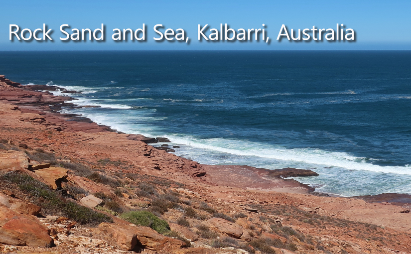
The best way I can describe the landscape around Kalbarri is simple: rock, sand, and sea. It sounds almost too basic, but after spending time there, I realized those three elements are everything, and somehow, they’re more beautiful together than we could have imagined.
Kalbarri marked the first stop on our journey north along Western Australia’s coast, and it immediately felt different from anywhere I’d been before. The town sits quietly between rugged wilderness and the vast openness of the Indian Ocean, as if it knows the landscape around it is the real star.
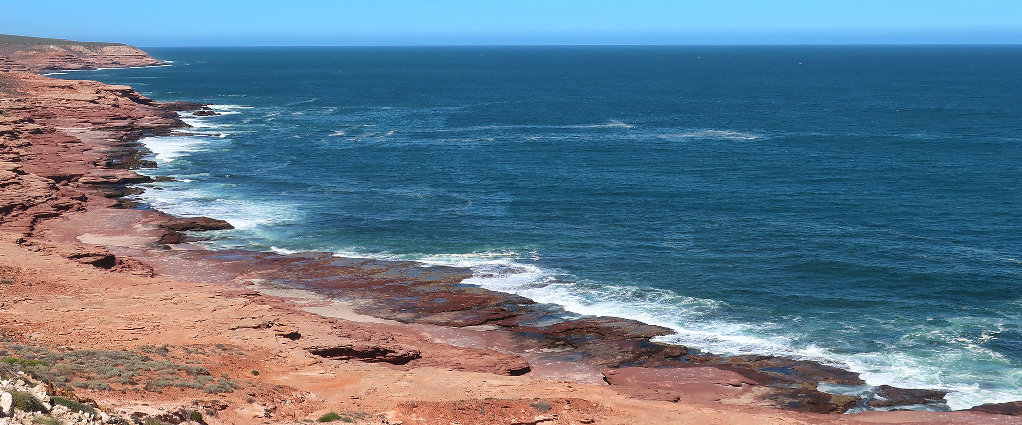
On our first morning, we walked along the shoreline and quickly learned that this is not a soft, gentle coast. The shore is either sand or rock, and where there’s rock, it’s wild and unforgiving. Cliffs drop sharply into the sea, carved into dramatic shapes by endless waves. The ocean stretched out in an almost unreal shade of azure blue, glowing beneath a perfectly clear sky. During our entire stay, I don’t remember seeing a single cloud.
The contrast was striking: deep blue water, reddish-orange cliffs, and bursts of white spray exploding upward each time waves slammed into the rocks. We could have stood there for hours just watching the rhythm of it — the steady crash, retreat, and return of the sea.
Inland to the Gorges
One day we drove inland to Kalbarri National Park, and the scenery changed completely. The coastline disappeared behind us, replaced by wide open land and ancient rock formations glowing in shades of red and rust.
The Murchison River winds through the park, carving deep gorges that feel impossibly old. Standing at the edge of one of the lookouts, I felt a quiet stillness that’s hard to describe — no city noise, no crowds, just wind moving across the cliffs and the immense scale of the landscape stretching in every direction.
It’s the kind of place that makes you pause without meaning to.
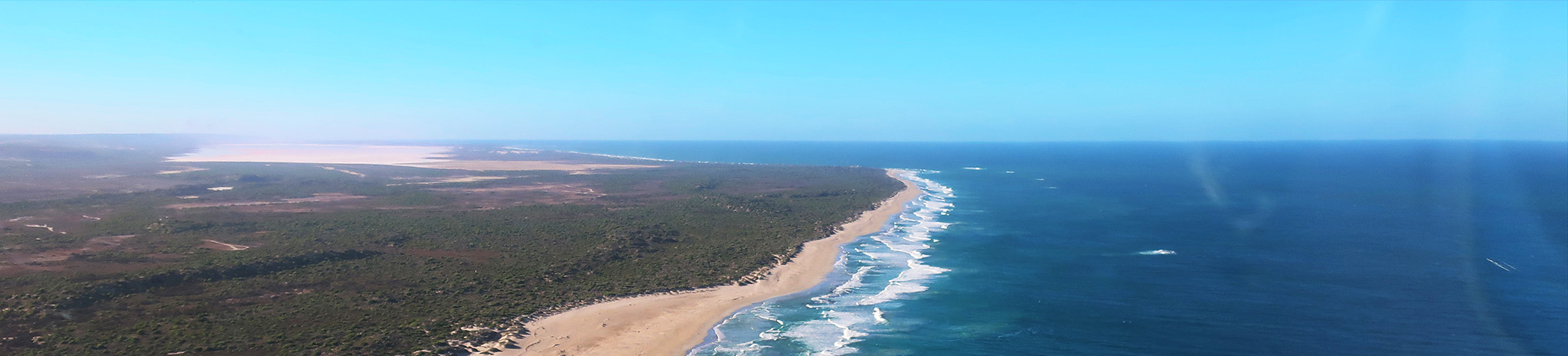
Seeing Pink from the Sky
One of the highlights of our time there was a short flight down the coast. I wasn’t quite sure what to expect, but the moment we reached Hutt Lagoon, I understood why people talk about it so much.
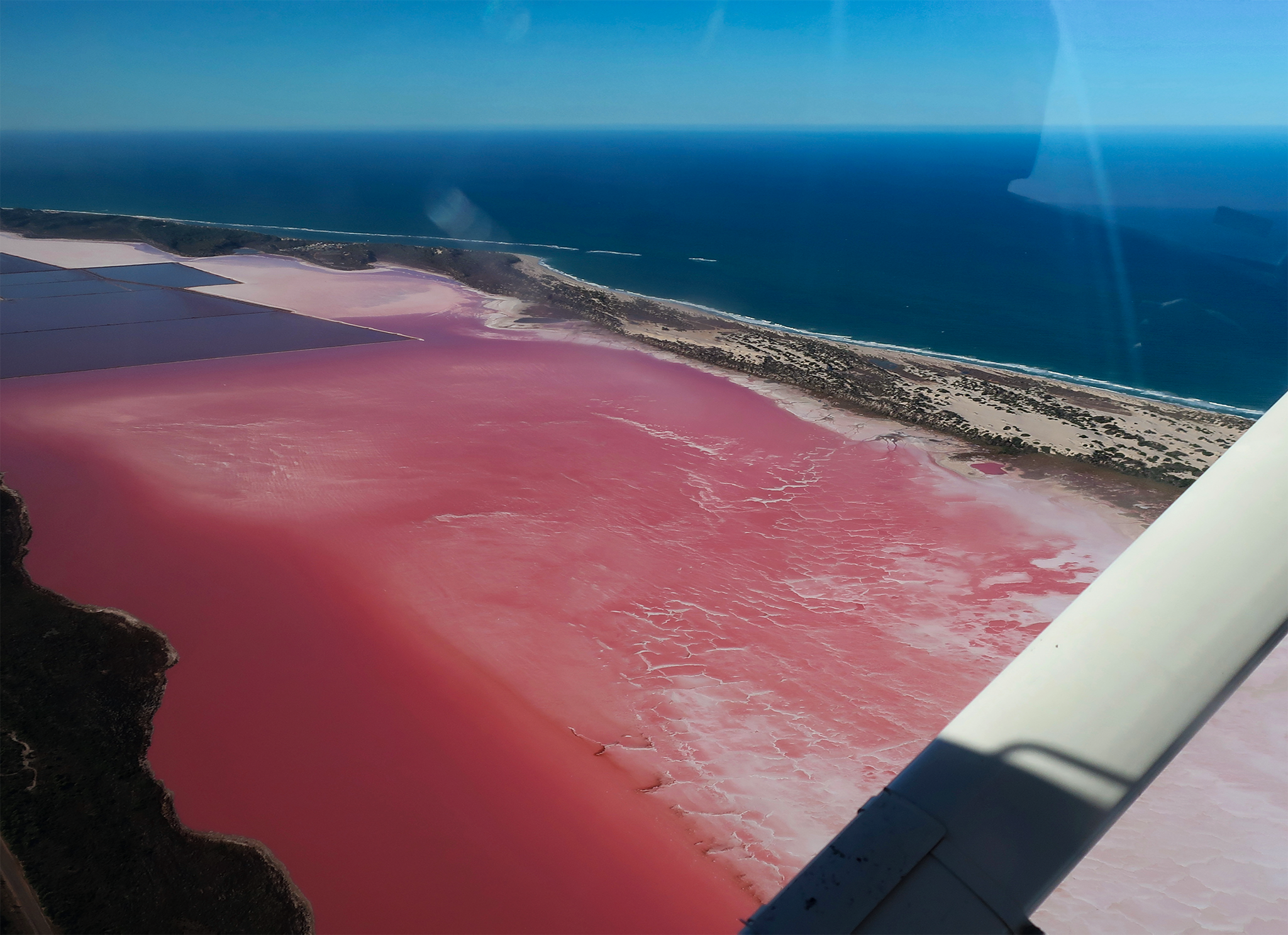 From the air, the lagoon looked surreal — a vivid pink lake sitting just inland from the ocean, separated by pale sand dunes. The colors shifted as we flew: soft blush pinks blending into deeper rose tones, edged by white sand and the dark blue sea beyond.
The lake sits below sea level, and seawater filters through the dunes before entering it. Microscopic algae thrive there, producing beta-carotene that gives the water its extraordinary color. Knowing the science somehow made it even more fascinating — nature quietly creating something that looks almost unreal.
You can drive to the lake, but seeing it from above felt magical. From the ground, you see a pink lake. From the air, you see patterns, textures, and color stretching across the landscape like a living painting.
First Impressions of the Journey North
Looking back, our first days in Kalbarri set the tone for the entire trip. Everything felt bigger — the sky, the coastline, the silence, the distances between places. It was raw and uncomplicated, shaped by natural forces rather than people.
Kalbarri isn’t flashy or crowded. It doesn’t try to impress you. Instead, it slowly works its way under your skin through color, scale, and quiet moments — waves crashing against ancient rock, endless blue skies, and landscapes that feel untouched by time.
By the time we left to continue north, I realized those three simple words still described it best: rock, sand, and water — but now they carried memories, movement, and a sense of wonder I hadn’t expected when the trip began.
Seeing Pink from the Sky
One of the highlights of our time there was a short flight down the coast. I wasn’t quite sure what to expect, but the moment we reached Hutt Lagoon, I understood why people talk about it so much.
From the air, the lagoon looked surreal ” a vivid pink lake sitting just inland from the ocean, separated by pale sand dunes. The colors shifted as we flew: soft blush pinks blending into deeper rose tones, edged by white sand and the dark blue sea beyond.
The lake sits below sea level, and seawater filters through the dunes before entering it. Microscopic algae thrive there, producing beta-carotene that gives the water its extraordinary color. Knowing the science somehow made it even more fascinating ” nature quietly creating something that looks almost unreal.
You can drive to the lake, but seeing it from above felt magical. From the ground, you see a pink lake. From the air, you see patterns, textures, and color stretching across the landscape like a living painting.
First Impressions of the Journey North
Looking back, our first days in Kalbarri set the tone for the entire trip. Everything felt bigger ” the sky, the coastline, the silence, the distances between places. It was raw and uncomplicated, shaped by natural forces rather than people.
Kalbarri isn’t flashy or crowded. It doesn’t try to impress you. Instead, it slowly works its way under your skin through color, scale, and quiet moments ” waves crashing against ancient rock, endless blue skies, and landscapes that feel untouched by time.
By the time we left to continue north, I realized those three simple words still described it best: rock, sand, and water ” but now they carried memories, movement, and a sense of wonder I hadn’t expected when the trip began.