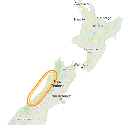
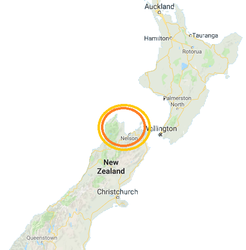
 We left Nelson and headed south for Hwy 6 along the Buller River. The river, and the highway, run generally west through the Buller River Gorge. Originally a gold rush town, Murchison was almost completely destroyed by a huge earthquake in 1929, and we were going to explore the heart of that earthquake. We first stopped at the Buller River Gorge Swing-bridge.
The Buller River Gorge Swing-bridge sits adjacent to the fault line from that 1929 earthquake, but getting there was a trip in and of itself. Hwy 6 provides a spectacular experience as you drive along the Buller River gorge; on one side you have a view into the gorge and the river itself. On the other side, the cliffs rise above you to the north providing spectacular mountain views. Because you drive on the left in New Zealand, I had a view of the drop to the river out my window while Julie marveled at the rising cliffs to our right. It was a spectacular view regardless (or, irregardless) of where you sat. About 10 miles west of Murchison we stopped, built up our courage and made our way across the Buller River Gorge Swing-bridge. While sturdy, I’d hardly call it a bridge, but it sure did swing.
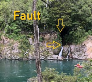 On the other side we explored some old buildings and walked for quite a distance through the crevice left by the 1929 earthquake. The crevice resulted from 4.5m (14.8 ft) of vertical and 2.5m (8.2 ft) of lateral movement that continued right across the water of the Buller River. It was interesting walking along the fault. We continued to the river and could see the offset on the wall of the gorge across the river as well. Then it was time to cross that ‘bridge’ again- we all successfully crossed with no issue. That was our excitement for the day.
Continuing west, just after Hwy 6 turns to head south along the coast we took Wilson’s Lead Rd. and headed for the Seal Colony at Tauranga Bay. That was the right choice as we had a chance to see plenty of seals and an incredibly rough coastline. It’s no wonder the point north of here is called Cape Foulwind. The blowing wind and relentless waves were both assaulting the rocky coast with wild abandon.
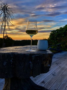 We spent our first night on the South Island’s west coast at the out of the way Birds Ferry Lodge. It’s a beautiful bed and breakfast that’s a bit off the beaten path but definitely worth the trip.
Alison and André were our hosts and made us feel right at home. Alison prepared a fantastic dinner, after which we relaxed on the deck with a great view of the mountains to the east and a colorful sunset to the west. André provided us with plenty of advice and several recommendations on how to make our adventures on the South Island’s west coast even more interesting. He also noted that fuel was an important consideration as there aren’t a lot of fuel stations along the west coast, so top off when you can.
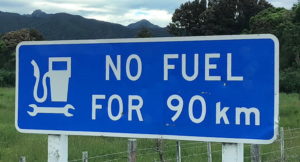 Since we had seen a sign that it was 90 km to the next gas station I was up early the next day and headed back to Westport (which we had bypassed the previous day) for gas. The largest city on the west coast, Westport tops out with a population of about 5,000. There were two gas stations in town! I fueled up and headed back to Birds Ferry for breakfast. Our first stop for the day was one of André’s recommendation – Truman Track.
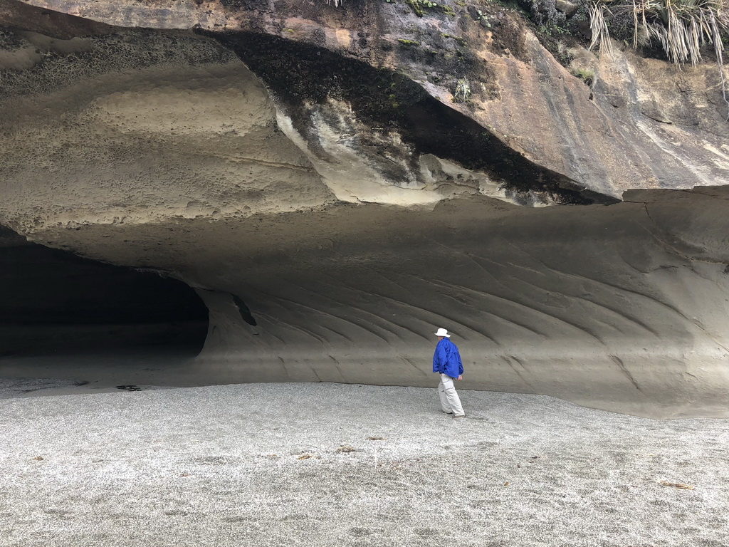 Truman Track looks uninspiring from the road – nothing but a path heading into the woods. The walk takes you through the small forest of native trees that opens into a field of flax bushes. We heard more birds than we saw. The track “officially ends” at a lookout point where we had an expansive view of the Tasman Sea and Truman Beach. We continued on to the right, down to Truman Beach via a small staircase.
The crescent shaped beach backs up to limestone cliffs that have been undercut and large rock formations carved by the wind and water. This place is beautiful to explore and we spent nearly 45 minutes under the overhangs and climbing and exploring the rock formations. If you make it to the South Island, this should be a ‘must stop’ on your journey.
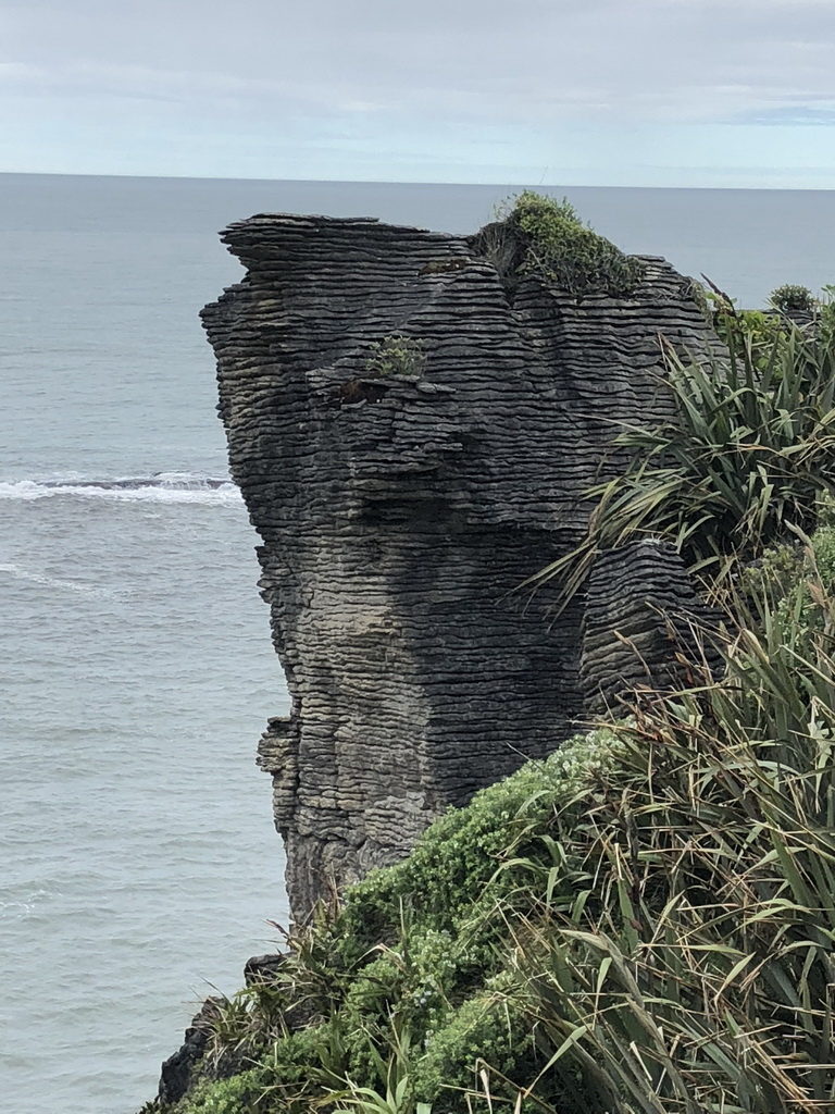 Pancake Rock is just a few miles down the road, but sharply contrasts with Truman Track. You can read about the geology of how these formations developed at the New Zealand Pancake Rock website. They resemble stacks of pancakes… but huge stacks… made of limestone. The area has a nice track for walking and there are several blowholes scattered among the rocks.
We weren’t there at high tide, however the blowholes and the deep chambers were still quite active. If you can, time your visit to coincide with high tide. You can get the tide schedule at this link for the Westport Tide Schedule.
We visited the end of November, and there weren’t overwhelming crowds, but this is a popular stop. Looking south from viewing area over the cliffs we could see the snow covered mountains of the far off on the distant horizon. The paths are well maintained and the blowholes are active, making this is a great place if you’re traveling with kids. (Just keep an eye on any little ones…)
Further south, we stopped in Hokitika for a late lunch and a chance to explore this interesting town. Then it was time to hit the road again since we had nearly two more hours of driving to get to our next stop. In this case, our next stop was the Franz Josef Glacier, located in… Franz Josef!
Related blogs
New Zealand’s South Island – Nelson
New Zealand’s North Island and Auckland
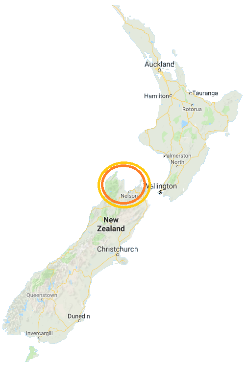 The South island of New Zealand has a lot to offer. We struggled deciding what to see in the two weeks we allocated to explore this place. There are towering mountains that surround peaceful sounds in the south and hug the rugged western coastline. Those were our targets – we’d start in the north and head west to explore the coast and then inland to explore the mountains and the natural beauty of the fjords in the southwest.
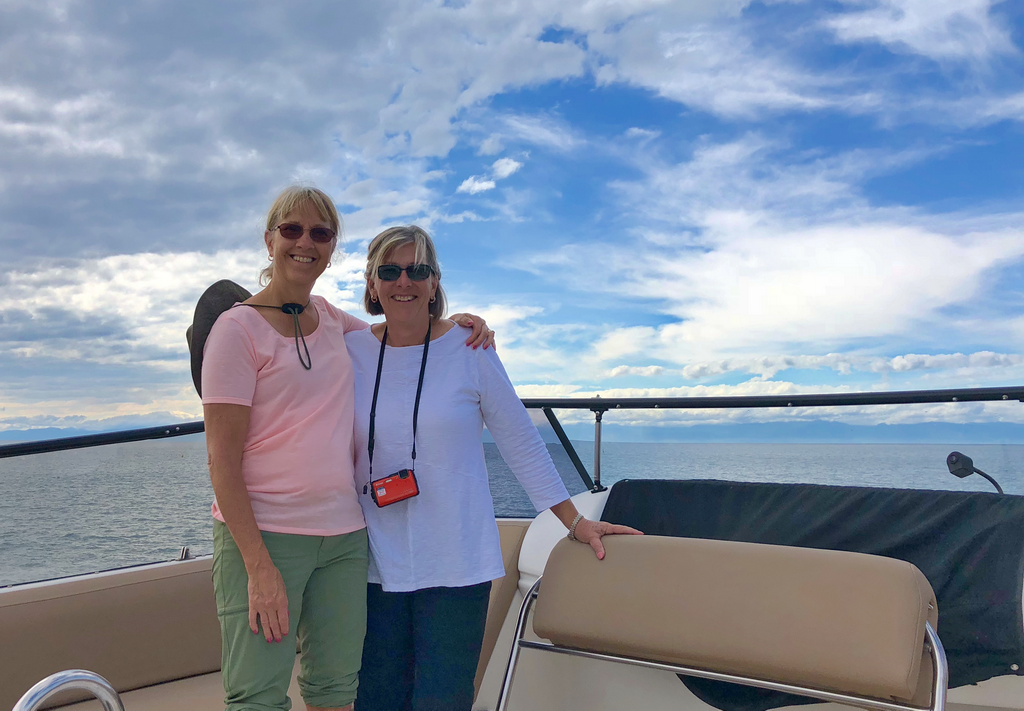 We saw seals, birds, dolphins and beautiful islands. Split Apple Rock was one of the first and most interesting sites. The crew, Captain Rob and his son, Angus, were patient and helpful at getting us in the best position for photos throughout the trip. With only six passengers, we had nearly unlimited flexibility in going where we wanted and staying as long as we wanted. We headed up the coast, stopping briefly off Adele Island, a bird sanctuary before continuing on. Along the way we relaxed and watched the seals in the water. Before breaking for lunch, Julie and I took our sea kayak and paddled into Bark Bay with John and Carol Brewer. It was a nice spot, so Julie and I hauled the kayak up onto a beach and hiked around the area for a bit before heading back for lunch on the boat.
 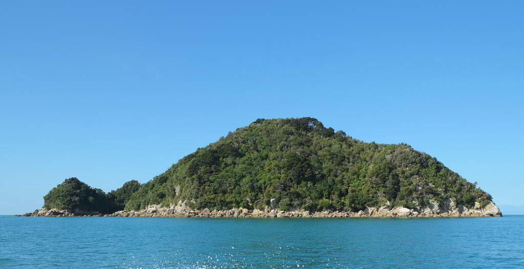 Along the way back we took the opportunity to walk through one of the most diverse coastal bush tracks on the Pitt Head Nature Loop. The hike was fun, but the views were amazing!